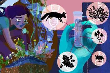
Citizen Science
Credits: Minas Faz Ciencia by Lorena Tarcia (2017)
Citizen Science involve actively citizens in science - as collaborators, contributors or leader of research - to generate a new knowledge or undestanding. Both the professional scientists and the citizen scientists benefit from taking part and the project's data and metadata are made public and the results are published in the open access format - always where possible.
See the 10 principles of European Citizen Science Association (ECSA)
See the 10 principles of European Citizen Science Association (ECSA)
Social
|
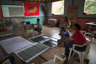
Geographic Information System
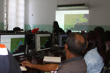
Ubatuba - Brazil - LindaGeo and CoAdapta projects. Credits: Allan Iwama (2018).
|
Interviews |
|
|
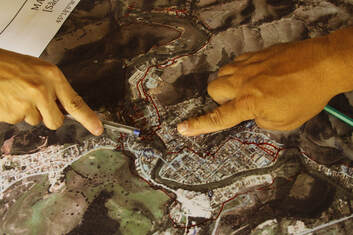
Social cartography consists of carrying out participatory mapping according to individual or a group/community perception about your vision of world. A social map that represents the daily life of a community. It can also represent the social mobilizations, whose purpose is to strengthen the social movements that exist in it in order to guarantee their rights (Acselrad 2008, Acselrad et al. 2013) .
|
The Geographic Information System (GIS) is a system designed to capture, store, manipulate, analyze, manage, and present spatial or geographic data related to positions on Earth’s surface.
This definition is support by wikipedia, National Geography, USGS, another others. |
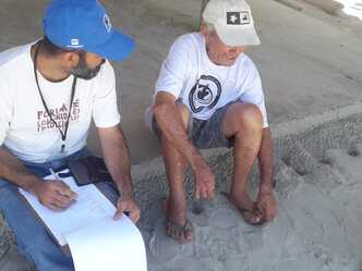
The interviewes were applied from the Nucleos CoAdapta community to your own community. The action research is methodology that seeks transformative change through the simultaneous process of taking action and doing research, which are linked together by critical reflection.
See wikipedia, Pahl-Wostl 2015, Somekh 2006. |
Participatory GIS
Quilombo of Campinho - Paraty - Brazil. The local working groups interactions CoAdapta.
Credits: Tiago Bambini (2018)
Participatory GIS (PGIS) is a participatory approach to spatial planning and spatial information and communications management. The Spatial information technologies, including Geographic Information Systems (GIS), Global Positioning Systems (GPS), remote sensing software and open access to spatial data and imagery, empower when the use is combining with participatory activities as social cartography, focus groups, etc. See more in wikipedia, IGI Global, participatory methods.


